While most of Scan2CAD’s users can be found in fields such as architecture or engineering, our software has applications far beyond the AEC sector. Jacob Martin, a graduate student at Texas A&M University, saw how useful Scan2CAD could be when converting Electrical Resistivity Imaging (ERI) for use in AutoCAD. Read on for his story.
Scan2CAD: Hi Jacob, thanks for your time! You’re currently studying for a PhD in near surface geophysics—could you tell us a little more about this subject?
Jacob: Geophysics is basically a set of remote sensing methods that allow humans to ‘see’ parts of the earth that we usually can’t (e.g., oil reservoirs 30,000 feet down or a landmine buried just under the surface). These methods use waves (sound, electromagnetic, thermal, gravitational, or light) to identify the thing of interest (e.g., the oil or the landmine) while ‘seeing’ through the stuff that surrounds the thing of interest (usually rock or dirt). It’s like when a fire fills a room with dense smoke, and the firefighters can’t see the people inside. They use a thermal scanner that picks up people’s body heat and can ‘see’ through the smoke. We use similar methods, and if those methods are used to investigate the top 300 or so feet of the earth, it’s called near surface geophysics.
A few other students at Texas A&M and myself research ways to look for groundwater, especially underground rivers flowing through buried, loose sand. We’re developing methods that let us ‘see’ these underground rivers so we can make 3D maps of where they are underground. Hopefully, this will allow farmers and ranchers to pinpoint the best location to drill new water wells for their crops and herds.
Scan2CAD: What drove you to study near surface geophysics?
Jacob: Well, where I grew up (Fort Worth, TX), everybody mutters about groundwater. Whether working outside or sitting around the dinner table, the conversation always comes around to “water level in the well has been getting lower”, “I think the water’s starting to taste funny”, and “I want to drill a new well but who knows if we’ll actually hit water…or if it’ll even be clean enough to drink”.
No one seemed to precisely know where the groundwater was, so I decided to try to find methods to survey the top 300 feet of the earth (where a lot of small scale operations get their water from) and make 3D maps. Using these maps, farmers and ranchers will be able identify where on the surface and how deep to drill for steady, clean water before they pay for the expensive drilling.
Scan2CAD: What is Electrical Resistivity Imaging (ERI) and why is it important?
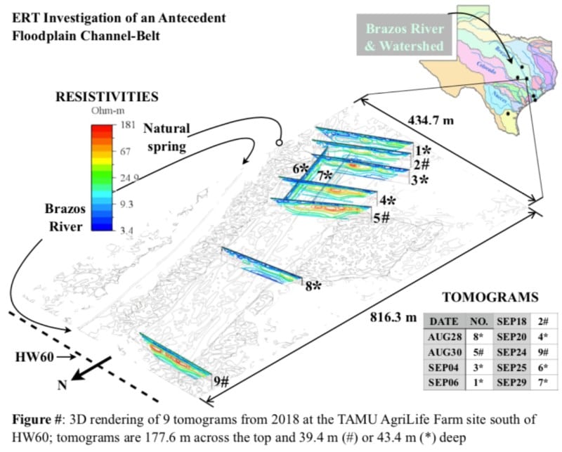
Jacob: ERI is similar to an X-ray. An X-ray is a ‘slice’ through your body, a map if you will of that particular plane that passes through you. ERI takes a similar ‘slice’ through the earth, a vertical slice that is called a tomogram. Using rebar pounded into the ground along a long line and connected to a control box, we scan for resistivity (how easily electricity moves through a material) at thousands of points underground. Sand has a high resistivity, and those values are labeled in orange and red on our tomograms.
Scan2CAD: Why did you need to convert the imagery to CAD?
Jacob: After running the ERI survey, the machine displays the 2D vertical tomogram (~583 feet long by ~135 feet deep). I could save the tomograms as raster PDFs, and I used AutoCAD 2018 to rotate them in 3D so I could see them in their correct positions in relation to each other. However, I couldn’t cleanly get rid of the white background for the tomograms, and that made my 3D map look as choppy as a cut and paste letter. So I went searching for a program that would cleanly get rid of the background and stumbled across Scan2CAD. The vectorization process did the trick, I input the new vectorized PDFs into AutoCAD, and the 3D map looked great. My professor gave me a high compliment for it.
But then the next day, quite by accident, I was playing around in AutoCAD when I saw a number appear in a sidebar. I had just discovered I could select a single color in a vectorized tomogram, and the number was labeled “Area”. I won’t get into all the details, but to calculate how fast water can flow through sand, one first has to calculate the area of sand it’s flowing through. I was getting ready to begin a several month project writing a code to calculate those areas from the raw data, and yet lo and behold, with Scan2CAD’s vectorized PDFs, AutoCAD could almost instantly calculate those areas for me.
My jaw literally dropped, and I ran down the hall to my professor. Bringing your boss news that you just found a three minute solution to what would have been a three month project is one of the best feelings in the world, and I am extraordinarily grateful that Scan2CAD let me have that feeling. Keep up the good work, and I look forward to continuing to use this amazing software!
Converting electrical resistivity imaging step-by-step
Interested in seeing how Jacob went about converting his images? Here’s a step-by-step guide to the process.
① In Scan2CAD, open a screenshot of a particular portion of the original JPEG of contoured data (underground electrical resistivity).
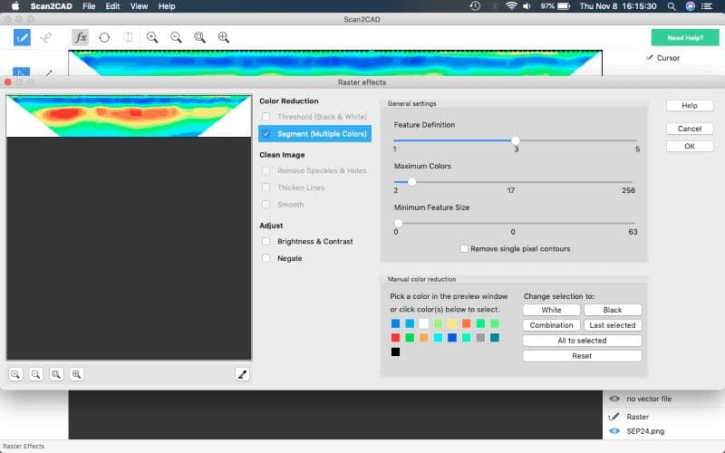
② Click the “fx” icon. Select Segment (Multiple Colors) under Color Reduction and change the Maximum Color Scale to 17. The original jpeg contour used 16 colors, plus 1 more for the black outline. Leave all other defaults unchanged. Click OK on the far left.
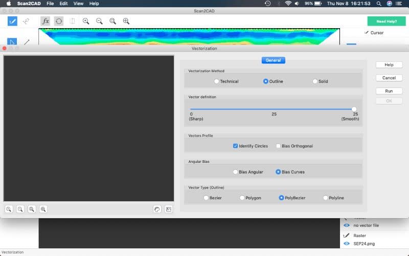
③ Click the Vectorization icon. Change Vectorization Method from Technical to Outline and increase the Vector definition from 5 to 25. Leave all other defaults unchanged.
④ Click Run on the far left. Watch the “Vectorization is now being performed…” bar.
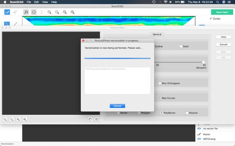
⑤ View the vectorized file.
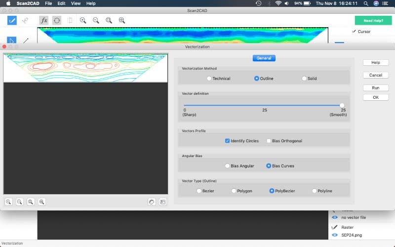
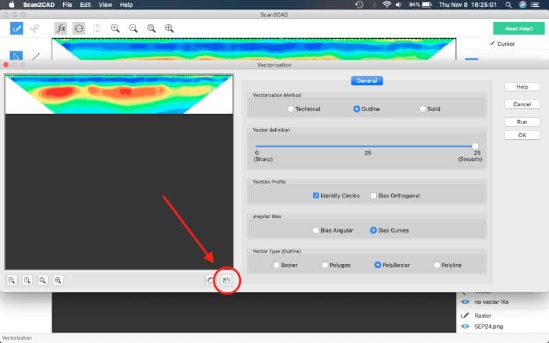
⑥ Click the Show Raster icon in the middle bottom of the current window. Compare raster image against vector and verify the vectorization process worked. Click “OK” on the far left.
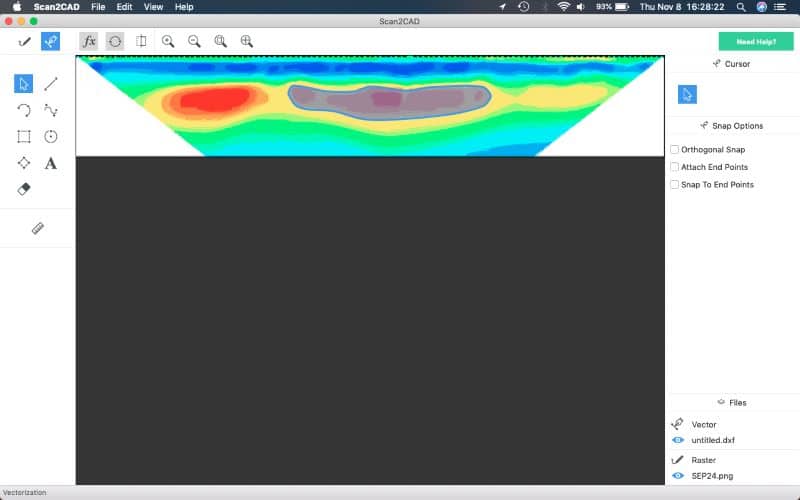
⑦ Scroll cursor over vector file to ensure it highlights sections appropriately.
⑧ Save file as PDF.
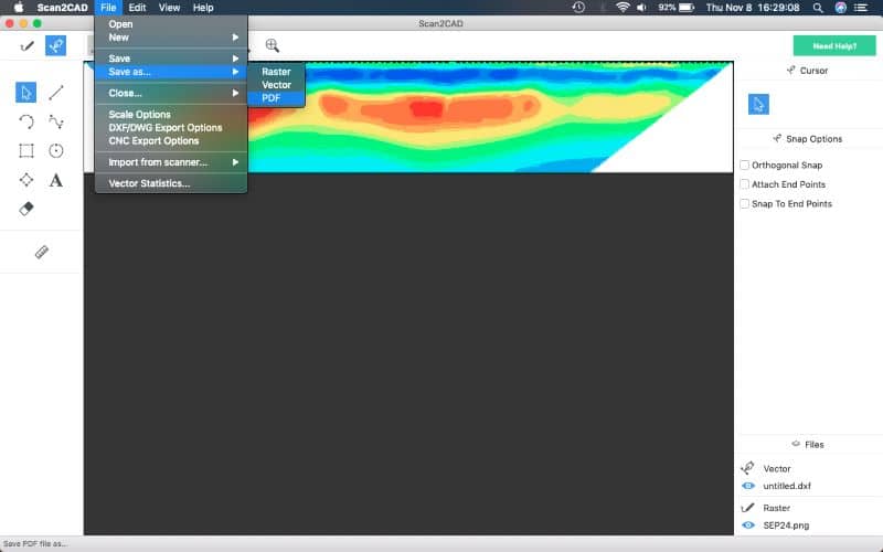
⑨ Open AutoCAD 2018. Wait patiently. Import vectorized PDFs, rotate in 3D, and arrange on vectorized screenshot of Google Earth.
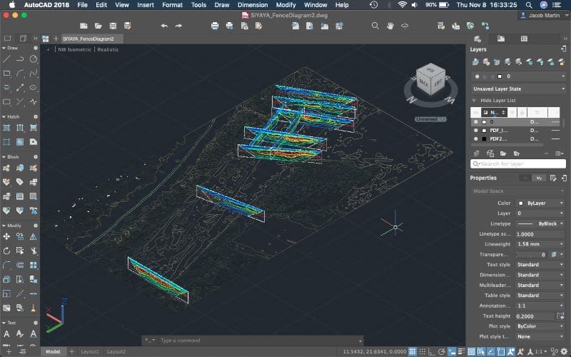
And that’s it!
You’ve seen what Scan2CAD did for Jacob. Why not see what it can do for you? Try Scan2CAD yourself with our no-obligation free trial. Just click the button below to get started.

